
Leaving Cuba, New Mexico, Route 126 makes up the next leg of the Jemez Mountains Trail. It’s paved on either end, but is dirt in the middle (yet is easily passable during good weather in any kind of vehicle). As soon as you’ve left Cuba behind, the road quickly heads into the hills, twisting and turning as it squeezes through cuts like the one above. Before long, you leave the desert landscape behind, and you’re in the mountains, surrounded by trees.

Once the pavement ends, you may need to slow down occasionally for a pothole or oncoming traffic, and the occasional cattle guard. It doesn’t take long before you come to a wide, sweeping curve, where another road splits off to the left. That road is Forest Road 103.

It, too, is a dirt road, but it’s also easy to drive. Much of the landscape through which it passes looks exactly like this — alternating between trees and meadows, dense growth and clearings. Meander about 10 miles up this side road, and you’ll find the attraction that makes this detour worthwhile:
Teakettle Rock

Looking like it was helicoptered in, and dropped in a completely inappropriate place, Teakettle Rock stands in a field at the side of the road. There’s a small parking area here, and a sign, which helped keep me from driving right past it.
Teakettle Rock is made of Cutler sandstone, and is shaped, more or less, like an old-fashioned teakettle. That handle is a “fin” natural arch, and while it obviously eroded, it’s not clear exactly how it formed. In addition to the obvious arch, the bottom of the rock is eroded, too. If you’re willing to get down and crawl in the dirt, you can crawl underneath it. And if you’re skilled in the basics of rock climbing, you could probably scale the rock in several locations.

Teakettle Rock looks out of place, until you notice the hillside on the opposite side of the road. There are other sandstone boulders there, scattered randomly to form a rocky playground. There are no fences in this area, and no people, so I didn’t see any harm in climbing around on them for a few minutes.

There’s no clear path up the rocky hillside, and no specific place you absolutely must see once you’re there. Every rock you climb just leads to a view of more rocks, scattered amongst the sparsely populated forest. By the way, for some perspective on where I was when I took this picture, notice the road in the background, and my rental car (just a dot in the photo), with Teakettle Rock (a slightly bigger dot) just behind it.
I don’t think there’s any reason to head further up Route 103. I turned around, and backtracked…

… past the cows that had wandered into the road (as seen on the Drivelapse video at the bottom of the page)…
Click on the image for a larger version.
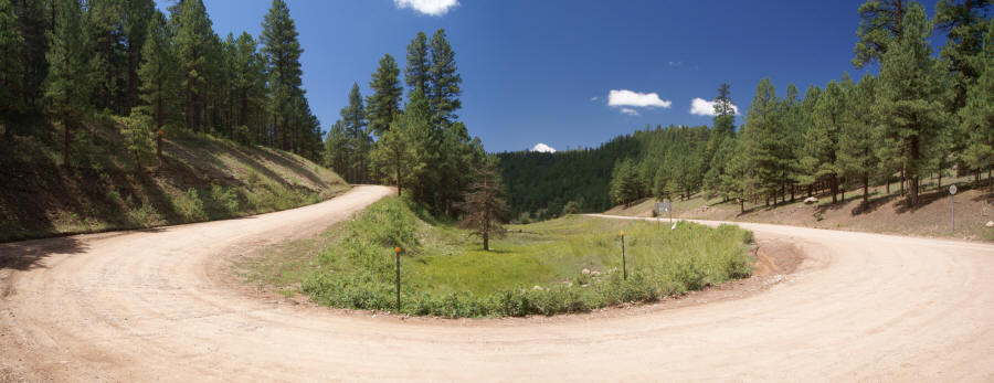
… and back to that aforementioned big curve in the road…

… where I met up, once again, with NM-126.

The road passes a few more interesting spots, including this outcropping of pockmarked rock.

You might also stop at this small cliff. There’s a parking area here, and you can look over the cliff, onto the road below.

As soon as you leave the parking area, the road drops down and curves around, to pass directly below the cliff.
It’s not much further until the pavement begins again, and it’s a smooth ride on to the end of NM-126, at the junction with NM-4.
Here’s the time-lapse, dash-cam video of the drive from Cuba to NM-4, via NM-126:


Farther up the road is the Rio Puerco Gorge. it is a recreation area with seven waterfalls.
http://www.dougscottart.com/hobbies/SlotCanyons/PuercoGorge.htm