Back in Washington, I planned to stop for the night in Chehalis. But it wasn’t quite dark yet, so I decided to see what Mount St. Helens looks like at sunset.
The mountain itself is a good hour’s drive east of I-5, but I was able to catch a glimpse of it beyond Silver Lake.
I took this picture (above) from a boat ramp, off of WA Rte. 504, the Spirit Lake Highway. If you continue east, the road will take you to the Johnson Ridge Observatory, which is the viewpoint closest to the volcano crater.
Spirit Lake Highway won’t provide you with a good view of Spirit Lake. So why the name? During the mountain’s devastating 1980 eruption, the upper portion of the road (which at that time did reach Spirit Lake) was blown away. The lower portion was also damaged by mudslides. Road crews rebuilt the highway, and reopened it in 1992.
If you want to see Spirit Lake, you’ll need to make a longer trip. And we will… but not today. With the sun setting, I headed back to Chehalis to spend the night.
US 12 – Near Mossyrock, WA: Riffe Lake Overlook
Leaving Chehalis on Day 6, head south on I-5 to US-12, then head east. The road to Mount St. Helens is about 55 miles away, but you’ll travel through some fine scenery along the way.

About halfway between I-5 and Randle, WA, US 12 passes by Riffe Lake. This is the view from the side of the road.
Hopkins Hill – Near Morton, Washington

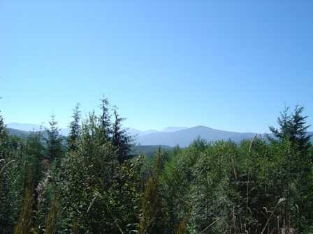
Just a short distance past Riffe Lake, you’ll see a turnoff promising a viewpoint of Mount St. Helens. The picture above shows all you’ll be able to see from this vantage point. The mountain is there, but the view isn’t great.

This sign is faded, but otherwise looks just the same as it did, when I visited as a kid, back in 1988.

From here it’s only a few more miles to Randle, a tiny town that marks the turnoff to Mount St. Helens’ Windy Ridge viewpoint.
Note: This trip was first published in 2004.


No comments