
My visit to Canyon de Chelly didn’t do it justice. After spending most of the afternoon wandering across the Navajo and Hopi Nations, it was only a couple of hours until sunset when I arrived. I made the best of the time I had, but you could certainly do more.

At the Canyon de Chelly Visitor’s Center, you can check out a reconstructed Kiva (a round building used for religious ceremonies).
I decided to drive the southern road first. At the far end of the road is Spider Rock, two narrow columns of rock standing in the middle of the canyon. Many photographers have taken pictures of the rock formation…

… but few came out as poorly as mine. I was there at the wrong time of the day — far too late for the sun to reach down into the bottom of the canyon. After taking a few equally-lousy pictures, I backtracked, stopping at a few other viewpoints along the way.
Canyon de Chelly

Canyon de Chelly really is beautiful, and I think it would be even better from the bottom. You can tour the floor of the canyon, provided you are accompanied by a Navajo guide who is certified by the National Park Service. Search the web and you will find several companies that will take you into the canyon for several hours, or overnight.

From some of the viewpoints, you can also view several old cliff dwellings, built by canyon residents hundreds of years ago. I didn’t get a good picture of them, because they’re all a long distance away.
On To Lukachukai, then New Mexico…
Once back at the “Y” near the Visitor’s Center, I turned onto Rte. 64 and headed northeast. There are a few overlooks off this road too, but because it was getting dark, I passed by all of them, without stopping.
So here was my plan. Take Rte. 64, then Rte. 12 to Lukachukai, then Rte. 13 over Lukachukai Pass into New Mexico, then find US Hwy. 491 and take it up to Cortez, Colorado for the night. That left a significant amount of driving ahead of me, and I soon learned one very big problem.
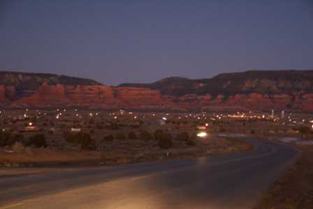
The above picture is of Lukachukai, yet another unexciting Native American town surrounded by incredible beauty. The colorful mountains in this area rival the beauty of Sedona, yet there are no five-star resorts here; as far as I could tell, not even an ancient roadside motel. In order to get into New Mexico, I had to take the only road through those scenic mountains. So, I drove through town and headed up the pass.
That’s when I found a “Road Closed” sign.
“Huh. The road is closed,” I thought. “That’s interesting. It sure would have been nice for them to post a sign saying Lukachukai Pass is closed during the winter, say, back at Canyon de Chelly!”
I slowly rolled forward, and found another sign, which explained that the road was indeed closed and would not be plowed again for months, but included the encouraging phrase “proceed at your own risk.”
Now, it wasn’t the least bit snowy or icy in Lukachukai. Even as I drove past the second set of warning signs, and began to climb into the hills, there was almost no snow. A quick glance at the map showed the incredibly long detour I’d have to take if I turned around. “OK,” I said to myself, “let’s give it a try.”
The road passed by some impossibly positioned boulders and rocks, with one switchback after another. Again I wondered why tourists don’t flock here to wonder in its natural beauty. I was too nervous, though, to stop and take a picture.
It didn’t take long before my mind was back on the road. After climbing for a mile or so, I noticed snow at the sides of the pavement. Then, a few patches of ice on the road itself. “No problem. Think back to when you learned to drive on snow. Just keep moving forward and you won’t lose your momentum and get stuck.”
Before long the road was completely covered with ice and snow. I could only assume there was still pavement under there, somewhere. To my encouragement, a couple of cars passed, headed in the opposite direction. “I’m not the only idiot,” I thought. “At least I can flag down some help after I crash.”
I crossed the pass with a realization. Until now I had been traveling uphill. Stopping wouldn’t have been much of a problem; simply take my foot off the gas and let gravity do the work. But now I faced a much straighter road, that was snow-covered and downhill all the way. I shifted into second gear, then first, and crept my way down to a lower, warmer elevation.
The pavement finally began to appear in patches, then the ice went away altogether. I had done something that I had never done before: cross a closed road, over a snowy mountain pass. I continued on to US 491, quite proud of my accomplishment.
If you pass through this area in the daytime, you’ll enjoy a good view of Shiprock, and some other mountains. It was so dark, I didn’t even know they were there.
Note: This trip was first published in 2006.


Ahhh! This post gave me anxiety! You are brave for continuing on, in the winter, in the dark on a “closed” road! I’ll be driving over this pass in a few weeks (going from Canyon de Chelly to Cortez for the night, then visiting Mesa Verde the next morning. Good to know that Spider Rock is bad at sunset and that the pass is scenic! Not much info out there about this pass so thanks for the post!