
The paved road that connects Capitol Reef to the outside world is Utah Route 24. The highway cuts through the park’s prominent feature, the Waterpocket Fold: the valley between two folds in the earth’s crust. If all you do is drive through Capitol Reef on Route 24, you’ll see some interesting mountains and rock formations, but to really experience the Fold, you need to drive through it.

As I started down Notom Bullfrog Road, it was hard for me to tell that I was in the Waterpocket Fold. The most dramatic feature on the horizon was a long mountain range, several miles to the west. It included a cluster of oddly-rounded mountain peaks. I didn’t drive all the way down the park’s scenic road (which starts at the visitor’s center), but I’m guessing you’d get a better, or at least closer, view from the other side.

The wide northern end of the Waterpocket Fold passes by a few rock formations during the first few miles.

About 10 miles down the road, the pavement runs out. Around this point, you have a nice view of what lies ahead. The valley starts to narrow dramatically during the next few miles.

For a couple of miles, the road passes by some beautiful irrigated farmland. As the name suggests, the Waterpocket Fold stays moist, thanks to the mountains on either side, funneling water into the valley.

About 18 miles from Route 24, the Fold has narrowed dramatically. The most impressive hills are still on the right. Much like the San Rafael Swell and the Coxcomb, this mountain range also rises at an angle.

The road squeezes in between some smaller angled rock outcroppings on the right…

… and some smooth, rounded, purple hills on the left. (Don’t get turned around — this picture looks back to the north.)
You might notice some mile markers at the side of the road. These markers count down to the intersection with Burr Trail — a dirt road that cuts through Capitol Reef National Park towards Escalante. 31 miles from the highway, you reach the Burr Trail turnoff.
Burr Trail Switchbacks

I’ve driven over some breathtakingly steep and frighteningly narrow roads, and squeaked around some dramatic hairpin curves, but very few can compare to the first few miles of the Burr Trail. In order to head east, Burr Trail must quickly climb out of the Waterpocket Fold. From the middle of the valley, you might think there’s no way a road can get to the top of the hill, but the Burr Trail Switchbacks do the impossible.
From the turnoff at Notom-Bullfrog Road, a faded caution sign grossly misrepresents what’s ahead. Ten miles per hour? Hardly!

This is Burr Canyon, and somehow, you can drive through it. The road quickly starts to climb…

… and twist…

… and turn, again and again…

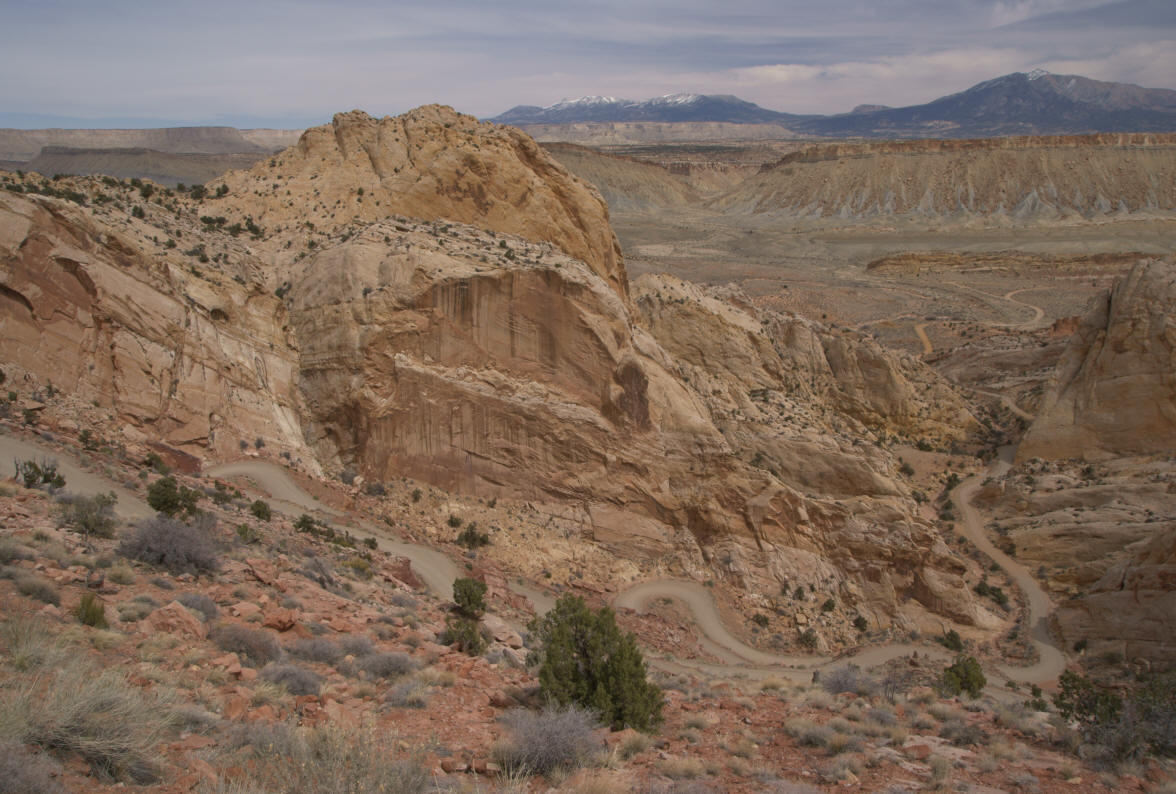
… until finally making one last curve, and reaching an incredible viewpoint:

Be sure to click on the link for a larger version. You need to see the big picture to take in everything you can see here. The big mountains in the distance are part of the Henry Range (we’ll get closer to them onUtah Route 276, on the next page). On the right, you can see the Waterpocket Fold, and Notom-Bullfrog Road. Burr Trail splits off and runs towards the bottom of the picture, then switches back and forth up the hillside.

Once you reach the top of the switchbacks, Burr Trail flattens out. There are a few more rocky hills, but the landscape is much flatter.

Since I wasn’t planning on driving back to Escalante, there was just one way to go: back downhill, through the switchbacks again.
Back on Notom-Bullfrog Road (which is also called Burr Trail south of this point), it’s 33 more miles to Bullfrog and Lake Powell. Just south of the intersection, you’ll pass a trailhead for Surprise Canyon. After about four miles, the road passes through several sharp turns and dips (which are subject to flooding), then leaves the park.
But, there’s one more good place to get a look at the Waterpocket Fold.
Halls Creek Overlook

If you have a four-wheel-drive vehicle, you can make a short detour off Notom-Bullfrog Road to Halls Creek Overlook. The side road gets extremely rough, just before you reach the viewpoint, so you don’t want to make this detour in a regular car.
From the viewpoint, you have a great view to the south…

… and to the north. You can also make a very steep hike down to Halls Creek (1.2 miles away)…

… and Brimhall Arch (2.4 miles, one way). You can see Brimhall Arch from the viewpoint. Because it’s so far away, it looks small and unimpressive, but it’s much better up close (even though it takes a lot of work to get there). Brimhall is a double arch, with the larger of arches measuring 120 feet across.
The road to the Halls Creek viewpoint is a loop, so you don’t have to return the way you came, and you’ll eventually meet up with Notom-Bullfrog Road/Burr Trail. However, you might want to backtrack. I found the southern end of the loop road to be rougher than the north end, and it also seemed to take much longer to get back to the main road.


[…] The Burr Trail, а с востока по приличной грунтовке Notom Road. Для любителей экстремальной езды там имеются дороги […]