After my awesome drive along the little-known Colorado River Road from I-70 to McCoy, Colorado, I was ready to follow any curvy line on the map, with hopes of making another exciting discovery. My destination was Silverthorne, and the easiest way to get there would be to take Colorado Highway 131 south, back to the interstate, and then follow I-70 east for 50 quick miles. Instead, I chose a more circuitous route: north on Colorado 131, east on 134 across Gore Pass, then US 40 south to Kremmling, followed by Colorado 9 south to Silverthorne.
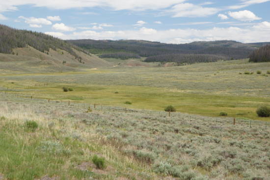
The scenery anywhere in Colorado is pretty good, so I’m not complaining. But, along this route, I didn’t find many excuses to stop the car and take pictures. Perhaps the most dramatic area was this wide, flat valley along Highway 134, west of Gore Pass.
There were a couple of interpretive signs at this stop, but they were generic — only talking about pine beetles and forest fires, and the natural processes which govern the forests. So, I don’t know if there’s anything special about this place, other than the special feeling you enjoy, traveling a wide-open, serpentine road like this one.
Gore Pass, elevation 9,524 feet, was uneventful. If you manage to notice the pass in time, you can pull off, and read a plaque attached to a stone at the side of the road, that will inform you that the pass is named for Sir St. George Gore, who traveled through here in 1855. A trail was here by 1866, a wagon road by 1874, and a paved highway by 1956.
Drivelapse Video
Here’s the time-lapse, dash-cam video of the drive from McCoy, Colorado, up 131, over 134, and down US 40, ending at Kremmling:


No comments