
The Rogue Umpqua Scenic Byway provides access to Oregon’s best collection of waterfalls (with the possible exception of the Columbia River Gorge). As you make the trip from Crater Lake back to Interstate 5, you’ll find plenty of places to stop, hike, and shower in the misty spray of a towering cascade.
After leaving Crater Lake (which was mostly socked in with fog and snow), the weather didn’t get much better. I’m fairly certain that I either turned the windshield wipers on or off at least once every mile. There would be a burst of sunshine, then a torrent of rain, followed by a moment of drizzle, then the process would repeat. Because of this, and because many side roads and turnoffs were still snowbound (in April), I didn’t get to experience as much of the Rogue-Umpqua Byway as I would have liked.

My first side-of-the-road stop was at a rest area/camping area that was closed for the season, but enough snow had melted to allow my rental car through. There were a couple of small waterfalls here, but nothing that compared to what waited up the road.

The Rogue-Umpqua Byway eventually turns from northbound (as it passes Crater Lake) to westbound. This happens just a few miles after you pass Mt. Thielsen, a 9,182 foot peak that was mostly visible, despite the clouds. Nearby is Diamond Lake, which offers some recreational opportunities in the summer. In April, though, the road around Diamond Lake was still snowed in, so I never even saw the lake.
Beyond Diamond Lake, Rte. 138 follows alongside the North Umpqua River. This is where you find the best waterfalls. I passed several falls that were down snowy side roads, but to my delight, the road to Toketee Falls was open.

If you’ve picked up any brochures about the Rogue Umpqua Byway, there’s a pretty good chance that you’ve seen a picture of Toketee Falls. This double waterfall is just about as perfect as they get. You have to walk about a half mile to see it, and you’re limited to one viewing platform, but it’s still worth it.

Countless years of erosion from rushing water have given Toketee Falls a unique look. The upper fall drops 40 feet, while the lower fall plunges 80 feet, as it spills out of the side of a sheer basalt wall.
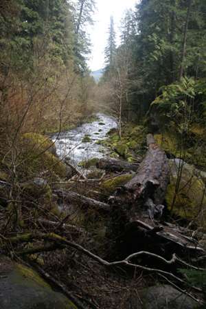
While the falls are nice, the walk to and from the viewing area isn’t all that bad, either.

Before you hop back in your car, take a closer look at the huge wooden pipeline that runs alongside the parking area, and directly into the mountainside. This water is diverted from nearby Toketee Lake, through a tunnel to a power plant on the other side.

Back on Rte. 138, the main road follows every twist and turn in the North Umpqua River, taking you through a dramatic canyon with a couple of notable rock formations.

What, you think I came back on a different day to take this picture? Nope, that really is blue sky, that appeared for just long enough to allow me to turn off my windshield wipers (for at least a minute or two).

My next stop was at a trail that led to the rather redundantly named Fall Creek Falls. Cross the double wooden bridge…

… then slide between a couple of huge boulders…

… and eventually you end up here. I think about half of those water spots on my lens came from the rain, the other half from the waterfall’s spray.

Of course, there are smaller waterfalls as well, along the path that leads to the big one.
After you pass the town of Glide (headed west), Rte. 138 becomes a little less interesting. If it’s raining or drizzling, it becomes a whole lot less interesting. Eventually, you end up at Interstate 5.
By this point in my trip, I didn’t really have a plan. I knew I had to be back to Portland by the end of the next day, but I didn’t have to get there in any specific way. So, I decided to hope for sunshine on the coast, and head back to US 101, to revisit some of the territory I had passed through, at the beginning of the trip.
Note: This trip was first published in 2007.


No comments