
Perhaps the only reason that Chama is alive and well today, and the biggest reason to visit this mountain village at the southern end of the Rocky Mountains, is the Cumbres & Toltec Scenic Railroad. The narrow-gauge steam railroad is obviously the most important thing in town, and Chama’s business district is designed to pull visitors off the train and into stores and restaurants.
There’s only one problem with this. In the winter, the snow piles up, and the trains stop running. And when that happens, the town virtually shuts down.
I was visiting in the middle of March, which is probably why I didn’t find much exciting in Chama, New Mexico. Keep that in mind as you read about my visit. Had I been here in summer, I probably would have fallen in love with the town. But this was still winter: there was slush and mud everywhere, the trains were snowed in, stores were closed, and I was disappointed.

Chama’s main business district is just a couple of blocks long. The biggest buildings are the two you see in the picture above–the square one and the round one. Inside are gift shops (but both appeared to be closed as I walked by). There are a few more businesses south of “downtown” on NM Rte. 17, and at the intersection with US 64/84. I was hoping to find a good restaurant serving New Mexican cuisine (specifically, green chile), but any restaurants I spotted either appeared to be closed for the season, or for good.

Perhaps the least touristy place in the downtown district is this small church.

Down the hill from Terrace Avenue (Chama’s Main Street, also NM 17), is the Cumbres and Toltec railroad station. Be warned: it’s a dirt road that runs past downhill, past the station, and then back up to the main road. In winter, as all that Rocky Mountain snow melts, the mud turns to muck, there are huge puddles, and if you’re driving a tiny rental car, you’ll be lucky if you don’t end up stuck. When I realized that the road was in terrible condition, I gave it the gas, and pushed my way through the mud, just barely making it back up and out the other end.
After learning my lesson, I parked along Terrace Avenue and walked down some un-shoveled snowy steps. My shoes sunk into the mud as I tried to explore the old train station.

Here’s why the trains don’t run during this time of year. Snow drifts easily reached 3-4 feet high, and this was during a relatively warm spell, when everything was already melting.

Train buffs will have a great time walking around here and seeing the old buildings and rail cars–especially during the summer. In March, there’s not a lot you can do without trudging through a lot of mud, or a lot of snow.
I had planned to spend much more time in Chama, but there wasn’t much else to do. I even drove down to US 64/84 and back again, just to make sure I hadn’t missed anything.
Heading out of Chama, the road quickly gains a lot of elevation. It is a thrilling drive–as are most journeys above 10,000 feet. You’ll soon be passing below mountain peaks, and above wide valleys.
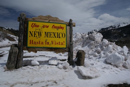
By the time you reach the New Mexico/Colorado state line, you’re already close to 9,200 feet. You still have about 800 vertical feet more to go, before reaching Cumbres Pass (elev. 10,022 ft./3048 m.)

Just look at that beautiful Colorado sky. Oh wait, I’m looking south, I guess that’s New Mexico sky.
For the first half of the distance between Chama and Antonito (the Cumbres & Toltec route’s two termini), the railroad closely follows the road. There are several railroad crossings that consist of a simple crossbuck sign (you know, the big X-shaped sign), but no lights or bells. In winter this is no problem, since you know there won’t be any trains on the snow-covered tracks. A short distance north of the state line, the railroad departs from the highway, and travels through its namesake Toltec Gorge, while darting back and forth between the two states several times. I’m sure this part of the rail trip is quite remarkable, and well worth it, if you have the time.
Note: This trip was first published in 2008.


No comments