
On the return trip from the Gila Cliff Dwellings National Monument, I decided to take the long way around: NM Rte. 15 south to Rte. 35, then Rte. 135 west to Silver City. This route completes the circle (or more accurately, triangle) made by the Trail of the Mountain Spirits Scenic Byway.
I chose to return this way, based on a suggestion on the National Forest Service website, which says the “long” route shouldn’t take any more time than the “short” route (taking NM Rte. 15 directly to Silver City) since the “long” way is 2-lanes, and less curvy. Turns out, they were wrong. Since I’m well-experienced on mountain roads, the “short” route only took me about 1:15, while the long route took well over two hours. It’s still a nice drive, but at the time, I was more interested in reaching my next destination, than taking in the sights.

If you choose the “long” route, you’ll find a couple of reasons to stop. Lake Roberts is right at the edge of the road…
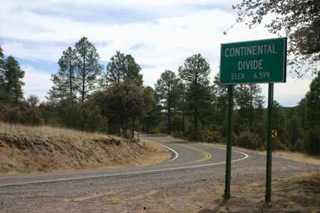
… and you’ll also traverse the Continental Divide (more than once–in fact, during day 4 I crossed it four times!)
From there, Rte. 35 continues through farmland. You’ll pass an old-fashioned general store in the town of Mimbres, providing a good place to stop for a beverage.
Once you finally make it back to Silver City, take a look at the time. According to my travel plan, I knew I had a lot of ground to cover, and it was already past noon when I arrived back in town. Even though I needed to stop for lunch, and wanted to explore some of the old shops and antique stores in downtown Silver City, I knew I didn’t have enough time. So, I drove straight through, not even stopping for a picture of the town.

There’s plenty to hold your interest as you travel up US 180, but if you find yourself looking for a short side trip, take a detour to the town of Gila. The tiny farming town sits in the shadow of the Gila Mountains and Wilderness.

There’s not a lot going on here, but you will find a general store if your snack supply is running low. This old, crumbling building is right next door to the general store, at the intersection of the town’s two major roads: NM Rtes. 211 and 153.
Gila Mountains & National Forest
A little further up US 180, you’ll find a nice turnoff and picnic area, that provides a fantastic view of the beautiful Gila Mountains and Wilderness.

Here’s a closer look at the mountains. The Gila wilderness has a lot of character, and best of all, it’s virtually untouched by humans. The only downside is, this is about as close as you can get, unless you’re willing to hike or travel on horseback.

No, this isn’t the end of the road, just the end of the parking area at the wayside.

As you head on up the road, you’ll pass several forest roads. I chose one for a quick side trip down to the Gila River (it was either Forest Road 24 or 42–my mental note is a bit fuzzy).
If you’d like to picnic by the river, this is a great spot. Best of all, you’ll probably be all alone. A guest register book shows this spot averages only 1-2 visitors a day… sometimes none at all.

As I drove down to the river, I was excited to see this cable car stretching over to the cliff on the other side of the stream. I had hoped that it was available for anyone to use. Unfortunately, it was chained and locked tight.
Note: This trip was first published in 2006.


No comments