
As the journey continues northward up the Icefields Parkway, the Saskatchewan River Valley looms in the distance — along with all the mountains that surround it.

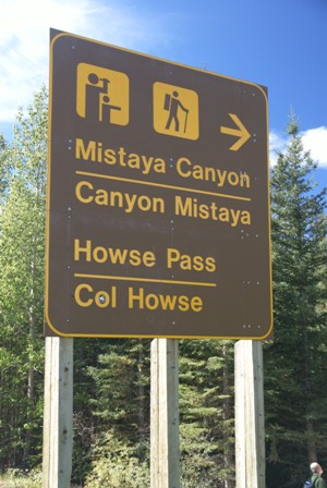
Before you get to the river, though, there’s another good chance to get out of the car and stretch your legs, with a short but rewarding hike into Mistaya Canyon.
The trail to Mistaya Canyon is only .5 kilometers (about 3/10 of a mile), but it’s a bit challenging since it’s all downhill (and on the way back, uphill). The trail itself is cut through the forest, so there are no good views…

… until you get to the slot canyon cut by the Mistaya river. The trail crosses the river on the bridge you see in the photo above, and after that, you’re free to wander around on the rocks, get as close to the edge as you dare, and find a nice spot to listen to the crashing waters below.

In places, the water is at least 10 meters below, squeezing through rock that shows the effects of swirling erosion.

Upstream, there’s no steep-walled canyon — only a whitewater river.
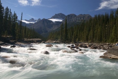
I found a rock and enjoyed the rushing water for a few minutes. Those big mountains to the south are likely Mount Sarbach and Kaufmann Peaks (3,155 and 3,109 meters, respectively).


No comments