
For the drive north towards the Denver area, and eventually Estes Park, most people take Interstate 25. It would have been an easy and fast drive, but I wasn’t interested in either. Instead, I noticed a dirt road on the map that parallels the Interstate, but runs along a mountain ridge. Rampart Range Road begins at Garden of the Gods, so I paid my second visit to the park.

The southern end of Rampart Range Road is located near the southwestern entrance to the Garden of the Gods. Two rock formations — Steamboat Rock (on the left) and Balanced Rock — tower over the entryway to this side of the park. The road splits, with one-way traffic squeezing through on either side of Steamboat Rock.
Just beyond Balanced Rock and Steamboat Rock, you’ll find the marked entry to Rampart Range Road. The sign says it’s suitable for 4-wheel-drive vehicles only. I think you can ignore this warning; Rampart Range Road was quite smooth and easily passable.

The road quickly gains elevation, and within moments you’re passing by this rock formation, that looks similar to Balanced Rock. The only difference is, there aren’t dozens of people here.

Drive a little further up Rampart Range Road, and great views of the Garden of the Gods start to appear.

Before long, you’re looking down on the rocky formations in the Garden of the Gods. Unfortunately, Day 5 was off to a gloomy start, and the entire scene looked somewhat grey. I’d love to see the view from here on a sunny, blue day.

Click on the image to view a larger version.
After passing several good places to view the Garden of the Gods and Colorado Springs…

Rampart Range Road makes a couple of switchbacks, then heads deeper into the mountains. Of course, it’s still climbing, and for me, that meant I was about to end up with my head in the clouds. The fog was so thick, that I really can’t tell you what you might see along the next few miles of this road.

Whatever view is out there, it must have been impressive enough to develop a couple of viewpoints. Clearly, this area was constructed a long time ago, and hasn’t been maintained for a while now. The handrails are slowly falling apart, and I wouldn’t suggest leaning against them.
I stopped here for a minute, and searched the fog for any clue of what I was missing. I couldn’t see a thing.
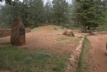
Just up the road a few hundred yards, I came across another stopping point. This one included a picnic area, and a plaque that explained the roadside park had been built by the CCC and the US Forest Service. It was dedicated on June 19, 1938.

For a few more miles, I wandered through the fog. Eventually, the clouds started to break apart, and I began to see mountaintops again.

In fact, a very big, very impressive mountaintop appeared out my driver’s side window. For the first time in two visits to Colorado, I had a perfectly clear view of Pike’s Peak.

The view got even better, as Rampart Range Road entered a clearing. This was a beautiful spot, with no trees — just a rolling, grassy field running along the top of the ridge…

… and stately Pikes Peak in the distance, towering over everything around it.

The road continued for, perhaps, another mile or so, before returning to the trees. Not far from here, there’s a road that will take you down to Woodland Park, Colorado. I’d strongly recommend that you go that way. I didn’t. Instead, I stayed on Rampart Range Road, and drove through trees — endless trees, mile after mile, with absolutely no good views. This would be a great area for camping, or perhaps ATV offroading, but it wasn’t the scenic wonder for which I had hoped.

I finally decided to give up on Rampart Range Road, when I reached this crossroads and parking area. If I had kept going, I would have faced 16 more miles of dirt, before running into US 85. “Devil’s Head” sounded interesting…

… but so did Rainbow Falls Park, which was eight miles down this side road. The sign also promised that CO 67 was just 10 miles away, so I figured I couldn’t go wrong.
But this road was definitely the wrong choice. I never found Rainbow Falls, and this smaller, less-traveled road was a lot rougher. It also had suspension-busting humps every few hundred feet (probably to channel flowing water off the road during rainstorms). Those hazardous, and nearly invisible speed bumps caused me to slam on the brakes a thousand times. It was a very slow drive, and it also wasn’t very scenic. Watch the Drivelapse video and you’ll see what I mean.

Fortunately, CO 67 was quite scenic. Even though it traveled through an area where forest fires had scorched the trees, it was still a beautiful landscape, with nice views of surrounding hills.

This straight stretch doesn’t last for long.
At Deckers, CO 67 and County Road 126 split. Stay to the left, and you’ll end up on CR 126, which will take you to US 285.
Since it was mid-afternoon, I decided the east side of the mountains might be too shady for pictures, so I decided I would head towards the west entrance of Rocky Mountain National Park, then take Trail Ridge Road to Estes Park. This would have been a good plan, if Guanella Pass had been open. Guanella Pass links US 285 to I-70, which would give me access to US 40 and Trail Ridge Road. But, Guanella Pass wasn’t open yet (it was still snow-covered, as of early June). I didn’t find out it was closed until I had driven all the way out to Grant, Colorado (where Guanella Pass Road begins). Then I had to backtrack to the east on US 285, and up CR 73 and 74. Since I was further east when I finally got to I-70, and since I had already wasted a lot of time with that detour, I decided to take the Peak To Peak Byway (CO 119, 72, and 7) to Estes Park, instead of making a long detour back to the west.
Drivelapse Video
Here’s a time-lapse dash-cam video of the drive up Rampart Range Road…
… and here’s the second half, which includes the bumpy detour over to CO 67…
… the drive up CO Route 67 and County Road 126…
… and US 285 from Grant to Conifer, then north to I-70:


No comments