
After you’ve visited Johnson Lake, follow the side road back to the loop road, then head north. You’ll pass Two Jack Lake, though it’s never seemed impressive enough to me to stop and take a picture of it. Two Jack is, more or less, just the tail end of the largest lake on this tour, Lake Minnewanka.

Click to view a larger version.

Lake Minnewanka stretches out for 28 kilometers (17 miles), and reaches depths of 142 meters (466 feet). The loop road drives atop the earthen dam at the lake’s western end — it’s because of that dam that the lake is so deep and long. The dam provides a great place to stop and take a panoramic picture.
Just beyond the dam, there’s a parking area. In the summer, you could rent a canoe here, or climb aboard a boat for a cruise up the lake. In winter, everything is closed…
Click to view a larger version.
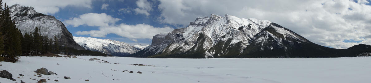
… but you can walk along the edge of the frozen lake, and take some nice pictures of surrounding mountains, like Mount Inglismaldie and Mount Girouard (these are the same mountains you’ll see from Tunnel Mountain, looking east).
Hike to Stewart Canyon

Lake Minnewanka does offer one short, easy hike, that’s just as accessible in the winter as it is in the summer. From the parking area, hike north, following the trampled snow along the shoreline. You’ll soon see signs for Stewart Canyon. It’s about 1.5 kilometers (slightly less than a mile) to the bridge that crosses the canyon.

For much of this hike, you’ll be gazing southward…

… and admiring those twin peaks of Inglismaldie and Girouard.

Eventually the trail turns, and another mountain, Mount Astley, comes into view.

I’m not certain, but I don’t think this is Mount Astley, but rather a ridge that connects to the summit. From here, though, it looks impressive enough to deserve its own name.

The trail skirts the lake’s shoreline, on a small cliff above the water (or ice), until eventually the trail turns into Stewart Canyon…

… and you reach the bridge that takes you across the Cascade River.

Looking up the canyon (which, no surprise, is also frozen and snowy), you get to peek at what’s probably the actual peak of Mount Astley.
Beyond the bridge, the trail goes uphill to the left, then hairpins back to the right — and then continues to follow the shoreline of Lake Minnewanka. I met a few hikers on the way up to this point, who told me they had heard “something big, maybe a bear” along the trail, just beyond the bridge. At first, I was determined to not let the possible sound of some mysterious, unseen animal deter me from hiking further. But then, I realized that there probably isn’t some “wow” moment in the following few hundred meters, so there wasn’t much of a reason to take the chance. I made the bridge my turnaround point, and headed back to the car.
Drivelapse Video
Here’s the time-lapse, dash-cam video of the drive to the lakes, starting in Canmore:


No comments